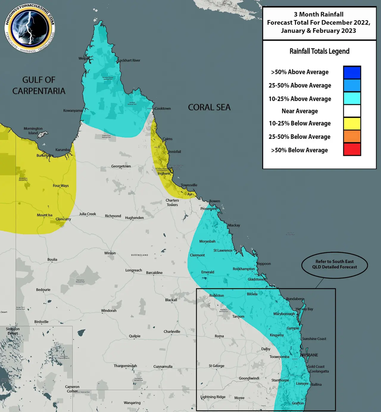
Issued December 5th 2022: During Summer of 2022/23 we are anticipating the negative IOD pattern to continue to slowly fade back towards neutral where it should remain for the remainder of Summer 2022/23. Despite this occurring, all model data is suggesting that La Nina is expected to hang around at least until January 2023, but potentially until February before it eases back towards neutral as well. The presence of La Nina will be enough to produce more than ample moisture content for rain and storms across Eastern QLD during this Summer period. Inland troughs are expected to continue to sweep across the country and reach Coastal areas – however with the lack of negative IOD assistance, these troughs are only expected to gain moisture the further East they travel. This should lead to reduced anomalies for rainfall across Inland areas of the State (potentially below average rainfall over the North West), along with a high reliance on these storm bearing systems to meet the demand of higher Summer averages for rainfall compared to the rest of the year. Above average rainfall is expected over much of Eastern and Tropical QLD for the simple fact that most rain and storm bearing systems are expected to gain moisture the further East they travel and also be more active across these areas. In addition to rain and storm systems, generalised rain periods are also anticipated across Central Eastern and South Eastern QLD at various times.
The only exception to the above average rainfall across the Tropics will be along the immediate Coastline of the Tropical North QLD Coast. The marginally below average accumulations predicted are simply due to 2 factors. The first being the extreme rainfall accumulations that normally occur in Summer, and secondly the reliance on a tropical system (low or cyclone) to impact this region heavily for these accumulations to be met. Localised average to above average totals are still very likely given overnight rain and storms can easily produce 100-200mm on any given night over these areas – especially during a La Nina year… however a 500-700mm dumping from a cyclone is extremely critical for these areas to reach the extreme thresholds provided.
These maps are really only to be used as a guide. Rogue extreme rain bearing systems, tropical lows and cyclones, rain depressions and even upper level troughs mixing with troughs to produce extreme rainfall can all happen at any time – but are only forecastable in the short term (long term forecast data is broad-scale and not precise like short range data). This could easily mean that anywhere across QLD (but more likely over Tropical or Coastal areas) could see significantly higher rainfall during Summer based on a single rogue event.