Issued 3rd December 2022: A combination of the ongoing La Nina weather pattern and negative Indian Ocean Dipole is expected to see rainfall and storm activity increase over the majority of the State – but especially the Tropics and Eastern / South Eastern QLD during the month of December. Most models are in agreement that repetitive rain and storm events are expected to occur over large parts of the State during the month, with these systems expected to reach Coastal areas where they will likely tap into higher moisture content and produce heavier falls over Coastal areas compared to Inland areas. The MJO (Madden-Julian Oscillation) cycle is favourable for some increased monsoonal activity during the start of the month… however it appears as though any tropical systems will be away from land areas. The general presence of the favourable MJO phase will help increase rain and storms across the Tropics though, and another wave of a favourable MJO phase could come around the end of the month which will again… increase rain and storms across the Tropics (regardless of any tropical systems developing).
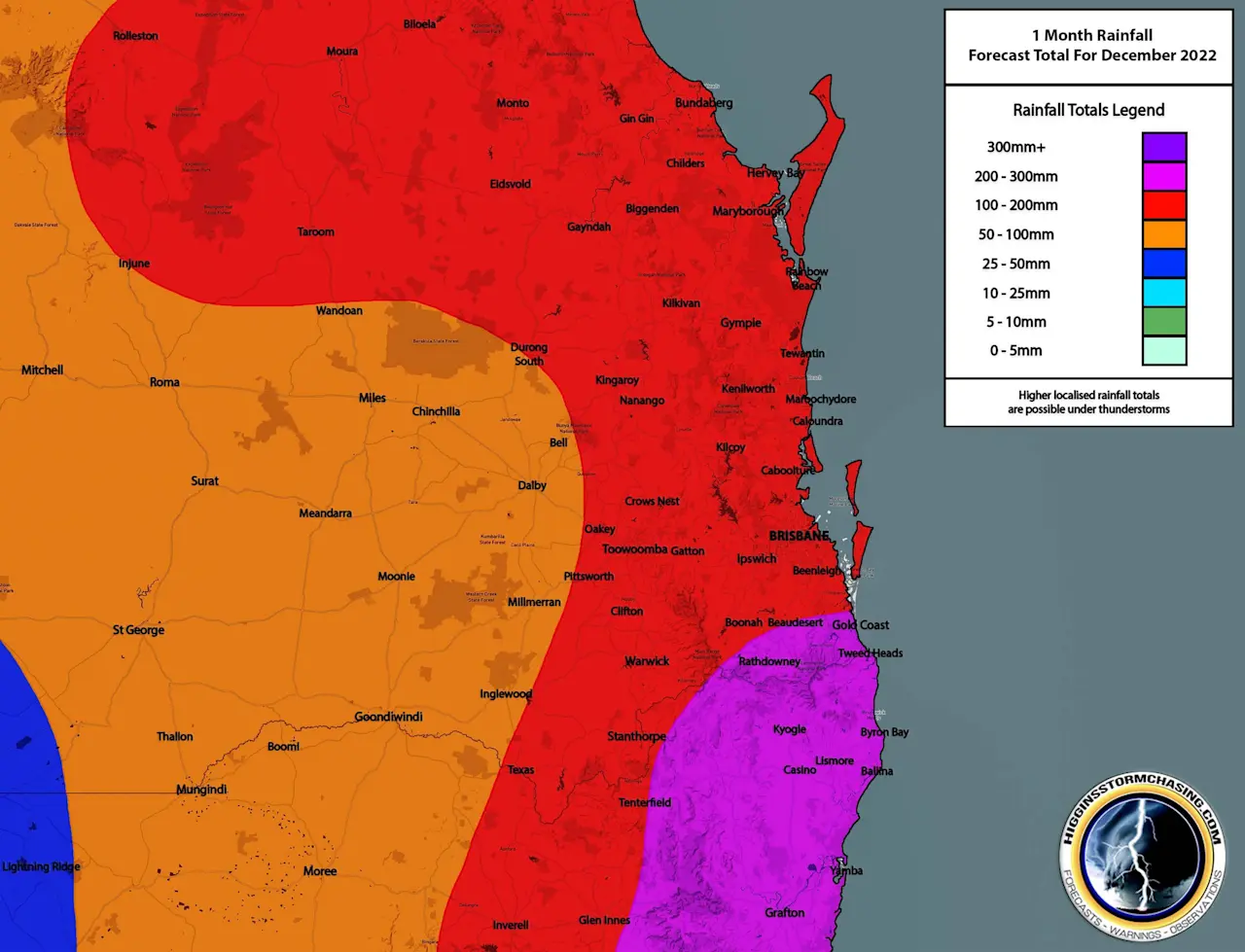
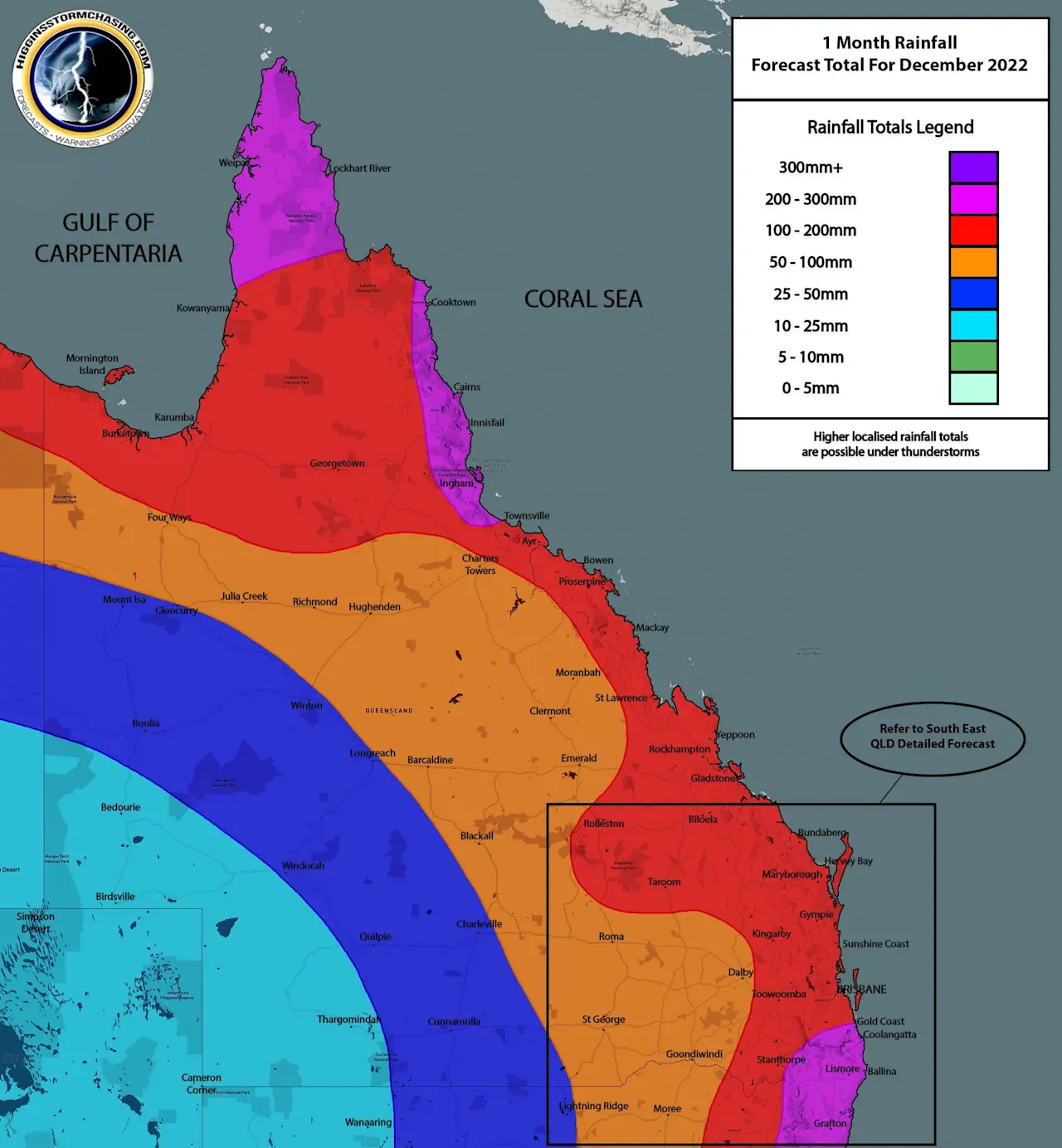
We expect above average rainfall across most of the State, with 200mm+ across the Peninsula, North Tropical Coast and widespread falls of 100mm+ across Eastern and Tropical QLD. Widespread generalised falls of 50mm+ are expected across North West, Central Inland and Southern Inland QLD wit rainfall tapering off further West. Individual higher accumulations are possible under storms given the high moisture content available.
Please refer to our DAILY forecasts for specific rain, storm and flood risk maps.