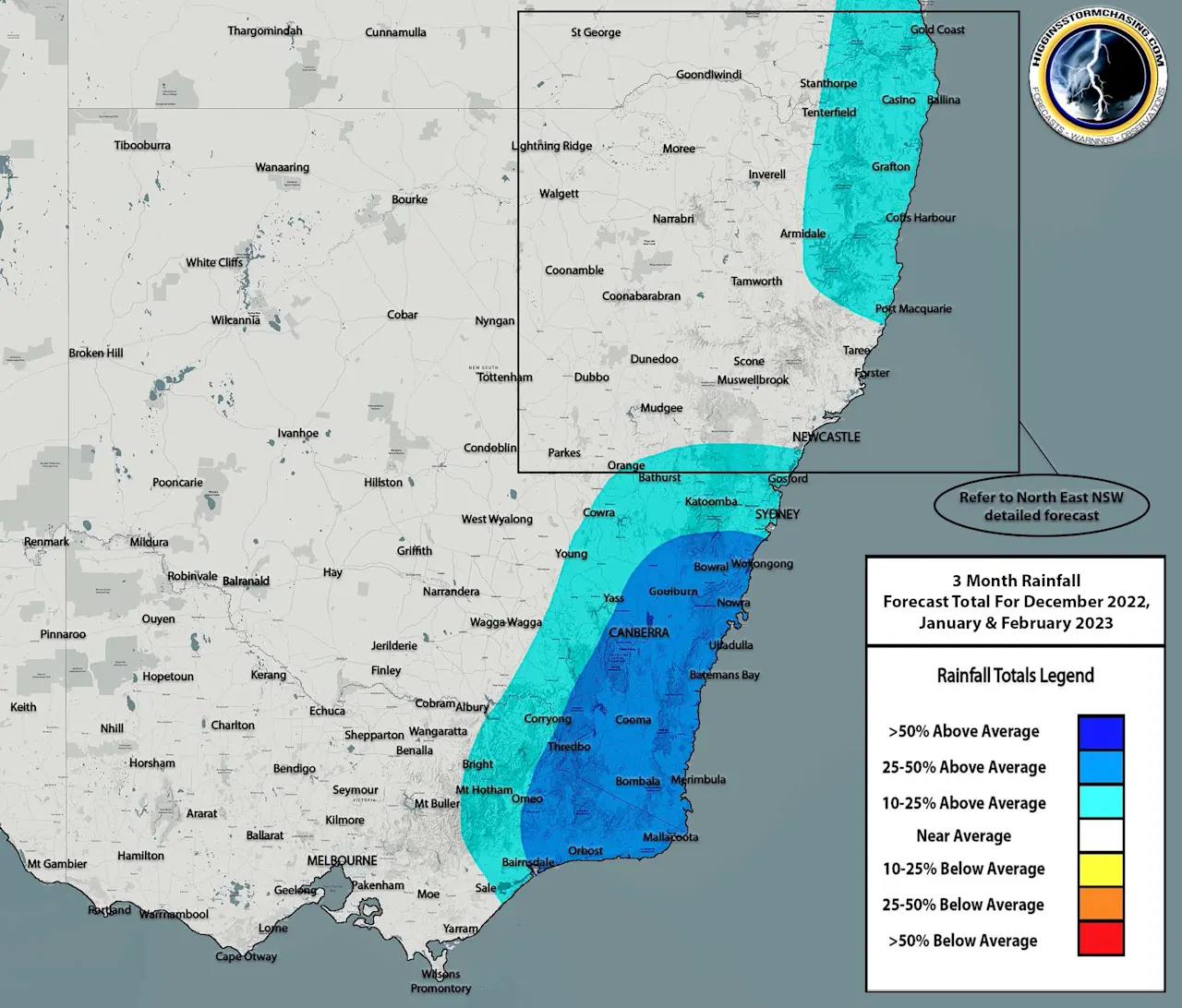
Issued December 5th 2022: During the period of December 2022 to February 2023, model data is continuing to suggest that the negative Indian Ocean Dipole is expected to slowly fade back towards neutral. This is likely going to have ‘some’ impact on Eastern Australia’s rainfall accumulations as there will inevitably be less moisture being carted from the Indian Ocean across North West WA and into Eastern AUS. Despite this, the La Nina weather pattern feeding in from the East (Pacific Ocean, Tasman Sea, Coral Sea) will continue to provide ample moisture for Eastern AUS. This will likely see above average rainfall continue over much of Eastern NSW, the ACT and into Eastern VIC with noticeably above average rainfall across South Eastern & Central Eastern NSW into Far Eastern VIC. Most rainfall during the Summer months is naturally reliant on thunderstorms rather than prolonged rain bearing systems such as East Coast Low’s across these areas – however with the trends of the negative IOD and La Nina weather patterns – it appears as though most storm and rain bearing troughs are expected to gain moisture as they move East and inevitably produce higher rainfall accumulations. In saying that, we anticipate there to be at least average rainfall for much of the remainder of NSW (including all Inland areas) and the remainder of VIC.
In saying all of that, it won’t take much for significantly increased accumulations occurring across anywhere in NSW in particularly, as there is always a risk (regardless of how low it is) for an Ex-Tropical Cyclone or rain depression to move down through QLD and into NSW – bringing with it considerably amounts of rainfall. There is also a risk that upper level troughs could create a favourable environment for extreme short term rainfall – both of these scenarios have occurred many times before, but are realistically only forecastable in the short term. These 3 month rainfall maps are a broad guide and do not represent individual systems which can cause way above average rainfall.