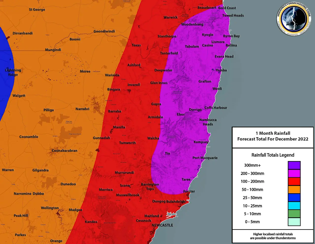
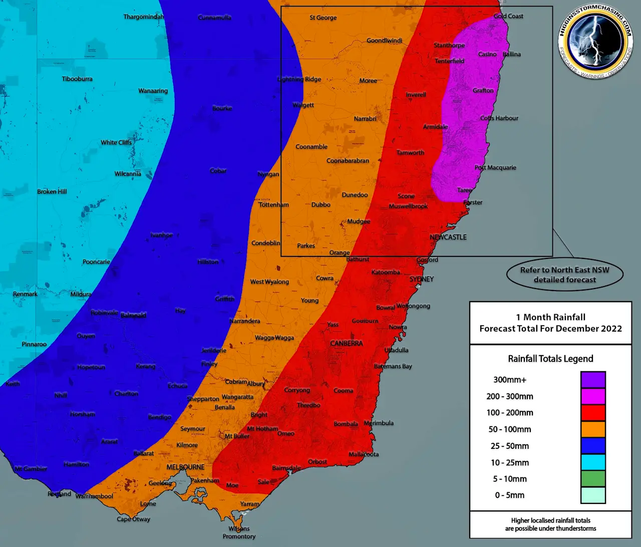
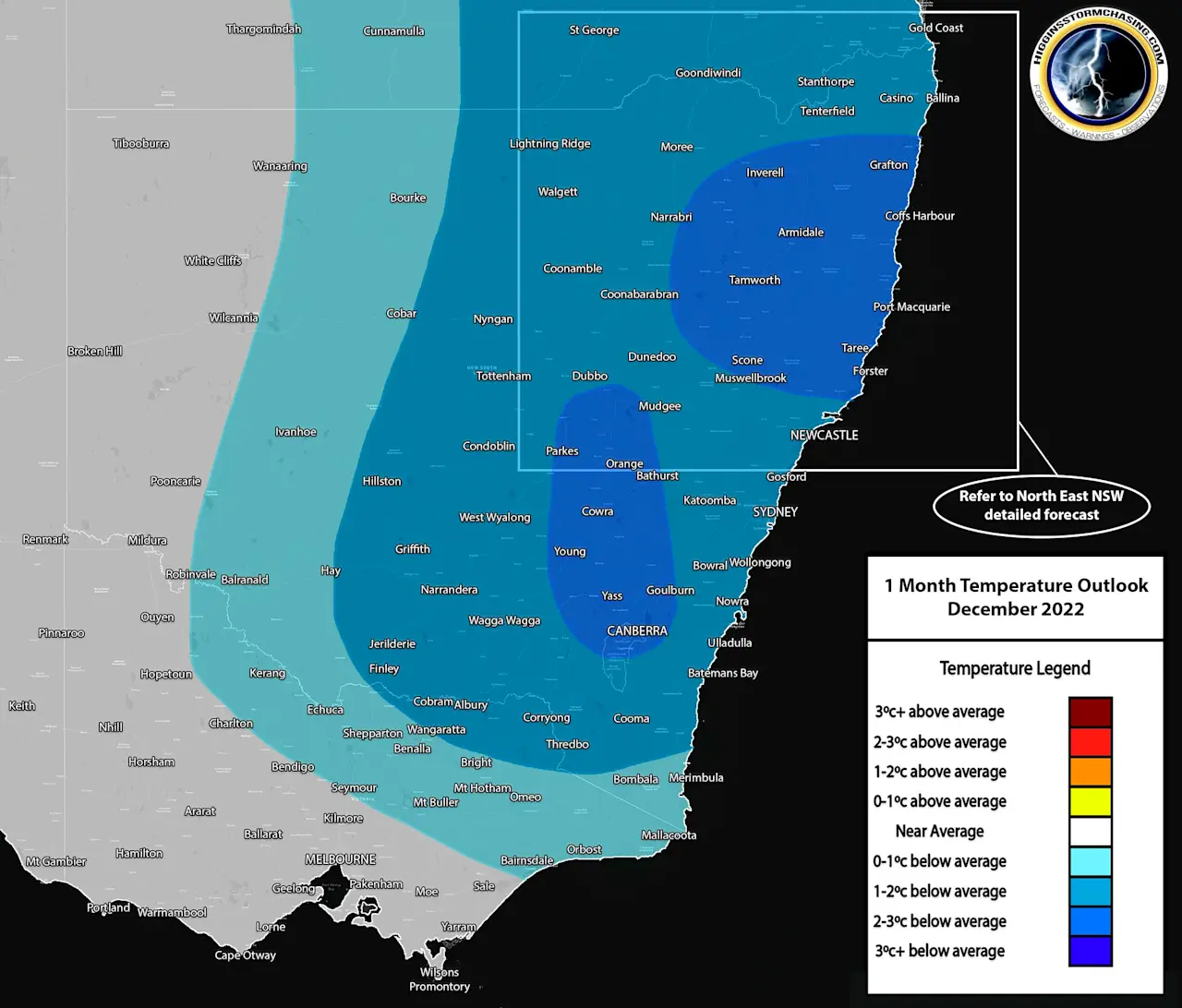
Issued December 3rd 2022: The La Nina weather pattern coupling with a continued negative Indian Ocean Dipole is expected to continue to produce not just ample moisture for repetitive rain events across NSW, VIC & ACT during the month of December – but also additional heat which naturally occurs during the Summer months, will become favourable for increased storm activity during December. Most models are agreeing that average to above average rainfall is expected over most of the ACT, VIC & NSW – with the highest actual accumulations forecast across NENSW. Widespread falls of 100mm+ are expected over the month across the ACT, Eastern half of VIC and areas along and East of the Ranges through Eastern NSW. Actual flood events will be hit and miss, as they will be based purely on how much can fall over large catchment areas in a short period of time… but in saying that, we are entering the month with numerous rivers and creeks across these State that are already exceeding minor/moderate (and in some cases, major) flood levels.
Please refer to our DAILY forecasts for specific rain, storm and flood risk maps.