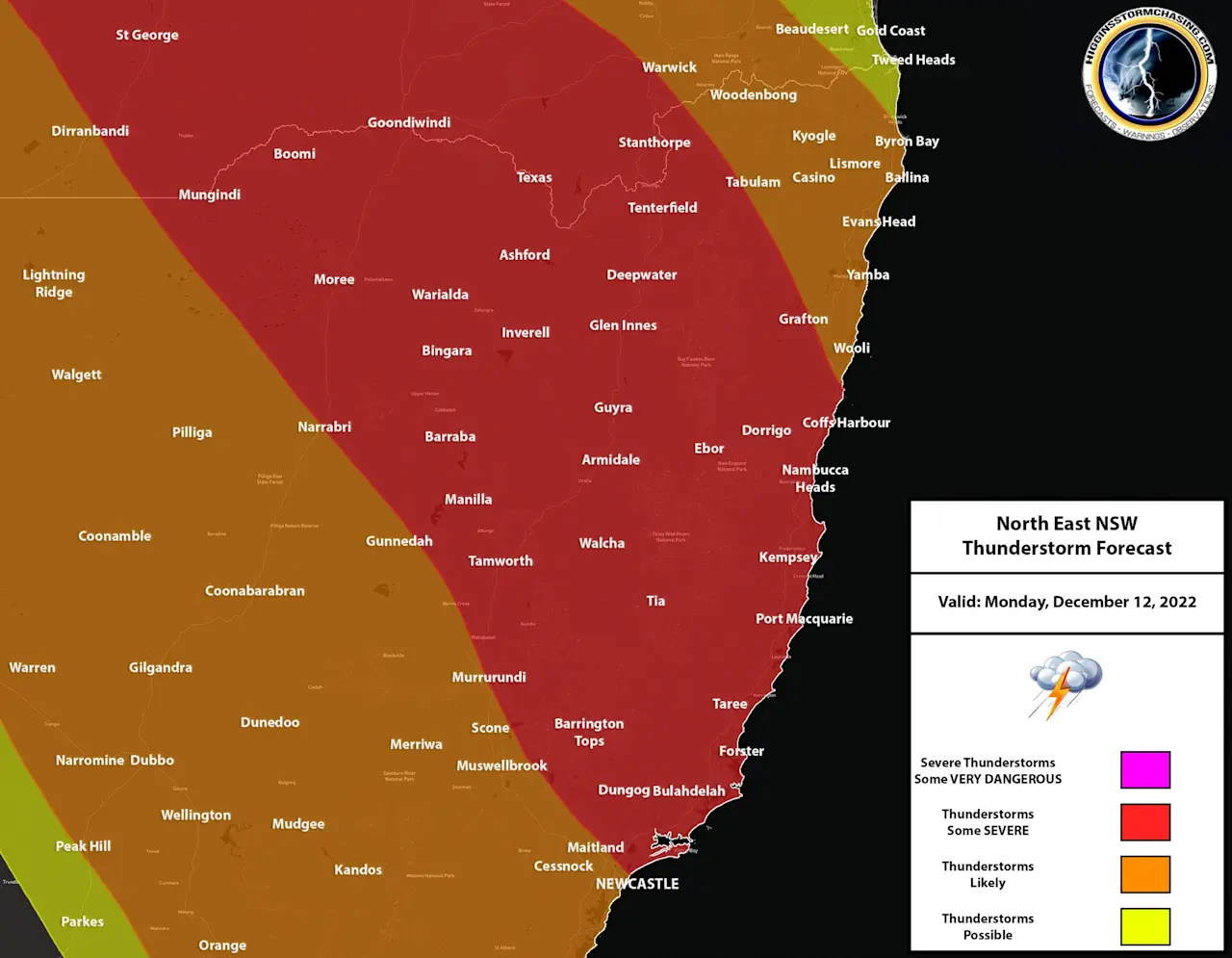
A surface trough is expected to move through the forecast region during the day – originating in the West and South of the forecast region, and then by the night.. it should have moved offshore. This trough is expected to draw in warm and humid Northerly winds ahead of it, with increased moisture and some increased upper level support feeding in behind it also. This combination is expected to produce widespread instability over the entire forecast region throughout the day.
During the morning, ongoing showers and possible storms are expected to be situated over Inland areas of the forecast region and through the Hunter. During the early afternoon, storms are expected to be already becoming more likely over these same areas, with one or two possibly already severe. During the afternoon and into the evening, storms are expected to spread towards the East across Northern Inland areas, the Northern Ranges, Hunter and Mid North Coast – with several storms likely becoming severe and one or two supercells also possible. These storms are expected to then spread into the Northern Rivers by the night, before moving offshore and/or dissipating.
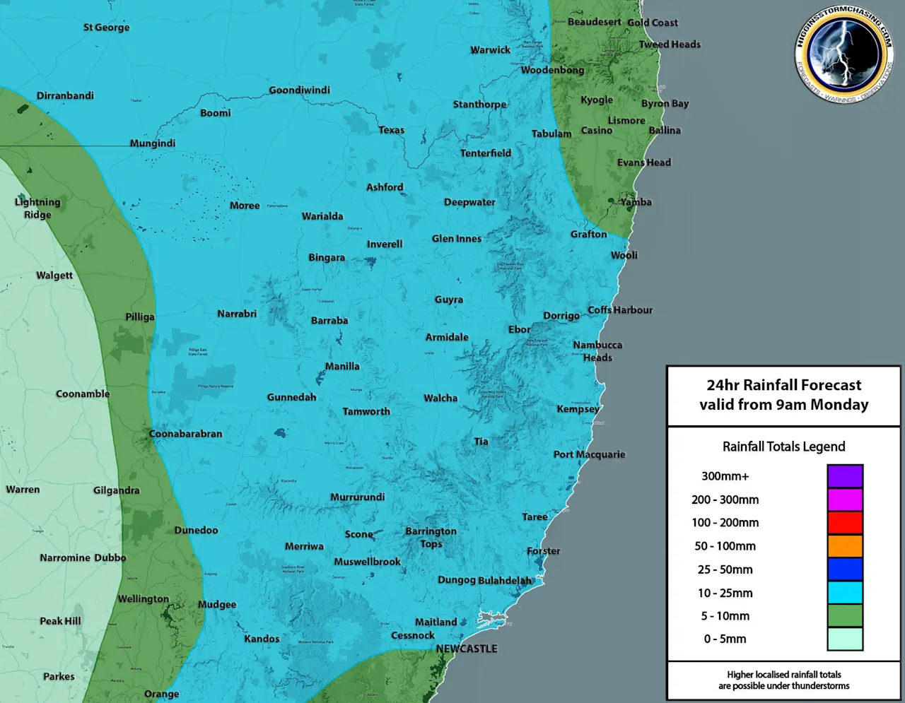
Any storms that become severe are expected to produce damaging winds, heavy rain & large hail – with bursts of frequent to very frequent lightning also expected with some storms. One or two supercells are possible with giant hail and destructive winds. Widespread double digit accumulations are expected over the forecast region, with locally moderate to heavy falls possible.
Temperatures: Tweed Heads 19-29ºc, Ballina 18-30ºc, Byron Bay 20-27ºc, Casino 16-33ºc, Grafton 17-33ºc, Lismore 16-32ºc, Coffs Harbour 19-30ºc, Port Macquarie 17-29ºc, Newcastle 20-31ºc, Scone 20-29ºc, Tenterfield 12-27ºc, Glen Innes 11-24ºc, Guyra 12-22ºc, Armidale 13-25ºc, Inverell 15-27ºc, Texas 18-33ºc, Tamworth 19-29ºc, Narrabri 20-29ºc, Moree 21-32ºc, Walgett 24-31ºc, Dubbo 18-26ºc.